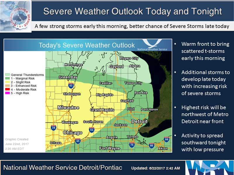
A cold front currently stretches from western Minnesota south to northeast Nebraska. A warm front stretched from central Wisconsin southeast to near Chicago. Thunderstorms were developing over Iowa and Wisconsin and moving toward Lower Michigan.
The next 24-30 hours will be stormy until the cold front passes through the state Friday. Several days of cooler weather will follow with highs in the lower to mid 70s over the weekend.
Today: Mostly sunny until midday then becoming partly sunny. Scattered showers and thunderstorms. Highs in the mid 80s. Southwest winds 10 to 15 mph with gusts to around 30 mph. Chance of rain 40 percent.
Tonight: Scattered showers and thunderstorms in the evening, then numerous showers and thunderstorms overnight. Lows in the lower 70s. Southwest winds 10 to 15 mph with gusts to around 25 mph. Chance of rain 70 percent.
Friday: Numerous showers and thunderstorms until midday, then partly sunny with isolated showers and thunderstorms in the afternoon. Highs in the upper 70s. West winds 10 to 15 mph with gusts to around 25 mph. Chance of rain 60 percent.
Saturday: Mostly sunny. Highs in the lower 70s. West winds 10 to 15 mph with gusts to around 30 mph.
Yesterday’s high temperature in Jackson was 76 at 5:35 PM. The low was 53 at 5:35 AM.
Normal high for today is 81. The record low is 39, set in 1972. The record high is 95, set in 1998.
.00 inches of precipitation yesterday. Month to date rainfall: 0.47 inches.
Sunrise today at 6:02 AM EDT. Sunset at 9:18 PM EDT.