Updated 11:15am. A weak cold front will produce scattered showers this morning before moving south of the area this afternoon. High pressure provides dry weather tonight and Wednesday, then humid conditions with showers and thunderstorms are expected on Thursday as a low pressure system tracks across Wisconsin.
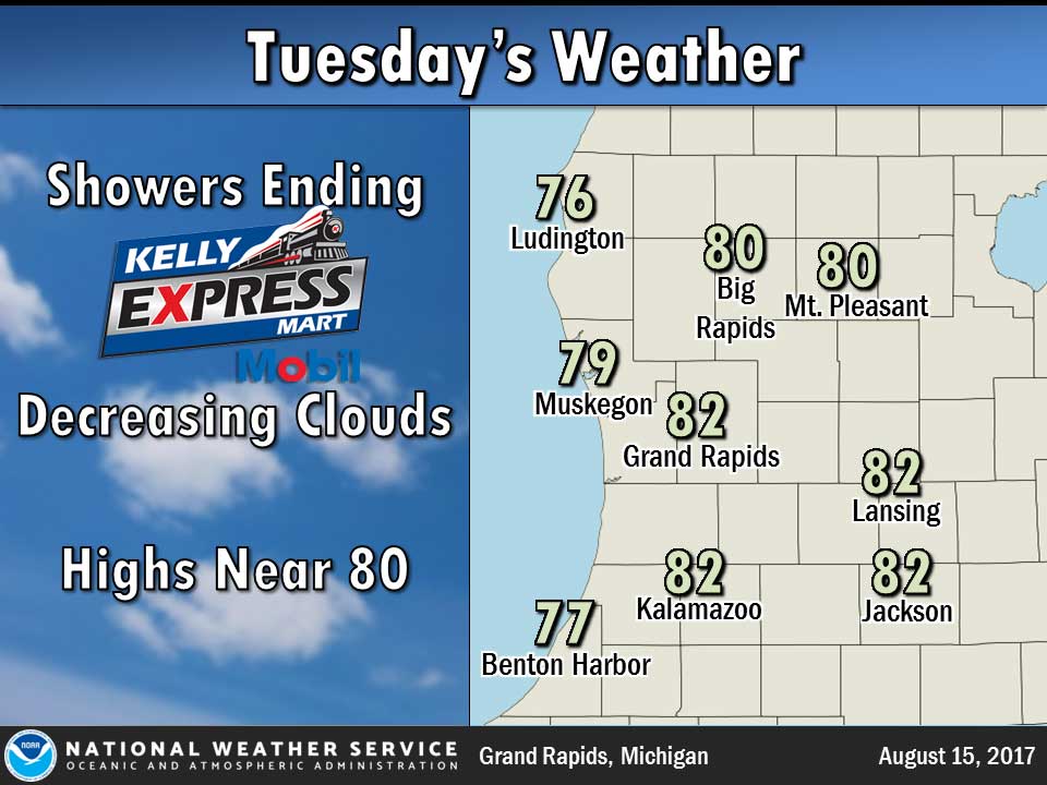
Today: Partly sunny until midday then becoming mostly sunny. A 40 percent chance of showers and thunderstorms. Highs in the lower 80s. Light winds.
Tonight: Partly cloudy. Lows around 60. Light winds.
Wednesday: Mostly sunny. Highs in the lower 80s. Southeast winds around 5 mph.
Wednesday Night: Partly cloudy in the evening, then mostly cloudy with a 30 percent chance of showers and thunderstorms overnight. Lows in the mid 60s. Southeast winds around 5 mph.
Thursday: A chance of showers and thunderstorms until midday, then showers and thunderstorms likely in the afternoon. Highs in the lower 80s. South winds 5 to 10 mph. Chance of rain 70 percent.
Yesterday’s high temperature in Jackson was 83 at 2:28 PM. The low was 59 at 5:46 AM.
Normal high for today is 80. The record low is 42, set in 1964. The record high is 97, set in 1965.
0.0 inches of precipitation yesterday. Month to date: 1.25 inches.
Sunrise today at 6:45 AM EDT. Sunset at 8:38 PM EDT.